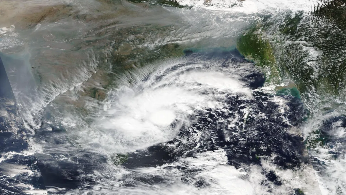
Cyclone Akvan forms today over the Bay of Bengal, the India Meteorological Department (IMD) confirmed on Monday evening, 16 November 2026. The deep depression that had been moving towards India’s east coast strengthened into a cyclonic storm during the evening, and it is now heading for the Andhra Pradesh coast, where it is expected to make landfall on Friday, 20 November.
In its bulletin issued at 7.50 pm on Monday, the IMD said the storm was centred over the central parts of the south and adjoining west-central Bay of Bengal at 5.30 pm, about 610 km east of Chennai, 660 km southeast of Machilipatnam and 670 km south-southeast of Visakhapatnam. The system had moved north-northwestwards at 10 kmph during the previous six hours. This evening bulletin is the first official confirmation that the system has become a cyclone and taken the name Akvan, a name suggested by Iran under the regional naming list maintained by the World Meteorological Organisation and the UN Economic and Social Commission for Asia and the Pacific.
01. Cyclone Akvan forms today: where the storm is now
At 8.30 am on Monday, the system was still a deep depression, centred near 11.2°N and 86.4°E, about 700 km east-southeast of Chennai. By the evening it had gained enough strength to be named. The IMD expects it to keep moving north-northwestwards and become a severe cyclonic storm over the west-central Bay of Bengal by Tuesday evening, 17 November, and then strengthen further into a very severe cyclonic storm by the morning of Thursday, 19 November.
The storm is the third cyclone to threaten the Andhra Pradesh coast in about three weeks. Very severe cyclonic storm Arnab made landfall near Narsapur on 28 October, and severe cyclonic storm Murasu crossed the coast near Ongole. The successive systems have kept the state on alert through the post-monsoon cyclone season, which runs from October to December in the Bay of Bengal.
02. When and where Cyclone Akvan will make landfall
The IMD says Cyclone Akvan is very likely to cross the Andhra Pradesh and Yanam coasts between Nellore and Tuni around noon on Friday, 20 November, as a very severe cyclonic storm. Cyclone Akvan forms today, and the IMD expects it to reach very severe strength before it nears the coast. Maximum sustained winds at landfall are expected to reach 120 to 130 kmph, gusting to 145 kmph.
That leaves about 500 km of coastline in play, nearly half of Andhra Pradesh’s 1,053-km shoreline, with Machilipatnam roughly in the middle. The forecast track and landfall point may still shift as the system develops, and the IMD has rated its confidence in the track and intensity as moderate to high, with considerable divergence among weather models on later movement. People in coastal districts should follow the IMD’s updated bulletins rather than a single forecast.
03. Rain, wind and sea warnings for Andhra Pradesh and Odisha
The IMD has issued an orange alert for the Andhra Pradesh and adjoining south Odisha coasts, placing them under cyclone alert. Heavy to very heavy rainfall is expected over coastal Andhra Pradesh and Yanam on 19 and 20 November, with isolated extremely heavy falls in north coastal Andhra Pradesh. Odisha is also likely to receive heavy to very heavy rainfall on 19 and 20 November.
Squally winds of 40 to 50 kmph, gusting to 60 kmph, are likely along the Andhra Pradesh and Yanam coasts through Tuesday, 17 November, and are expected to strengthen to gale force as the storm intensifies. Sea conditions are forecast to be rough to very rough through 17 November and will worsen after that. Fishermen in Andhra Pradesh have been told not to go to sea until 20 November, and fishermen along the Tamil Nadu coast have been advised not to venture out between 16 and 21 November.
04. What the states are doing to prepare
District administrations in Andhra Pradesh have been placed on high alert and have advised a complete suspension of offshore operations. In neighbouring Odisha, authorities have alerted all 30 districts, opened 24-hour control rooms and put National Disaster Response Force, Odisha Disaster Rapid Action Force and fire service teams on standby.
For people living along the coast, the practical steps are simple: Cyclone Akvan forms today, so the next 48 hours matter most for preparations. Follow the IMD and the Andhra Pradesh State Disaster Management Authority for the latest bulletins, keep emergency supplies and important documents ready, avoid the sea and beaches until the storm passes, and do not spread or trust unverified forecasts on social media. The IMD issues updated bulletins several times a day, and the next ones will confirm the storm’s strength on Tuesday and its exact landfall point as it nears the coast. Our earlier updates tracked the system from a depression to a deep depression earlier on Monday; this is the first confirmed report that it has become Cyclone Akvan.
Sources: The New Indian Express, Ommcom News and The Hindu, all reporting the IMD’s bulletins of 16 November 2026. Earlier Newsy coverage: Cyclone Akvan update: deep depression to become a storm this evening and IMD issues pre-cyclone watch for Andhra Pradesh and Odisha.